


Voting District 32460, Contra Costa County, California
About
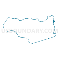
Outline

Summary
| Unique Area Identifier | 529878 |
| Name | Voting District 32460 |
| County | Contra Costa County |
| State | California |
| Area (square miles) | 1.86 |
| Land Area (square miles) | 1.39 |
| Water Area (square miles) | 0.48 |
| % of Land Area | 74.35 |
| % of Water Area | 25.65 |
| Latitude of the Internal Point | 38.02471650 |
| Longtitude of the Internal Point | -121.57321080 |
Maps


Graphs
Select a template below for downloading or customizing gragh for Voting District 32460, Contra Costa County, California


Neighbors
Neighoring Voting District (by Name) Neighboring Voting District on the Map
- Voting District 30920, San Joaquin County, CA
- Voting District 32450, Contra Costa County, CA
- Voting District 54455, Contra Costa County, CA
Top 10 Neighboring County Subdivision (by Population) Neighboring County Subdivision on the Map
- Stockton CCD, San Joaquin County, CA (343,203)
- East Contra Costa CCD, Contra Costa County, CA (119,315)
Top 10 Neighboring Elementary School District (by Population) Neighboring Elementary School District on the Map
- Oakley Union Elementary School District, CA (33,213)
- Knightsen Elementary School District, CA (2,470)